


.webp)
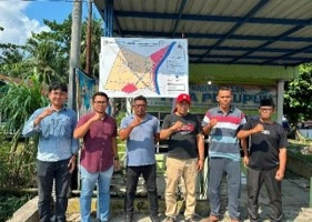
The Faculty of Engineering USU, through a multidisciplinary team of lecturers, carried out a Community Service (PKM) activity under the LPPM USU Disaster Mitigation Scheme in Paya Perupuk Village, Tanjung Pura District, Langkat Regency. The activity aimed to strengthen community preparedness for flood risks through the preparation of spatially based evacuation routes and points, as well as the provision of supporting evacuation facilities in the form of rubber boats.
The Community Service Team under the Universitas Sumatera Utara LPPM Disaster Mitigation Scheme implemented the program “Participatory Mapping of Spatially Based Flood Evacuation Routes and Points in Paya Perupuk Village, Langkat Regency.” The activity was directed at strengthening the capacity of residents of Paya Perupuk Village, Tanjung Pura District, to understand risks and prepare for a more organized evacuation process.
 |
 |
The community service team involved lecturers from the Faculty of Engineering USU from various fields of expertise. The activity was led by Ir. Robi Arianta Sembiring, S.T., M.Eng., IPM. from the Undergraduate Program in Civil Engineering, with members Dr. Anthoni Veery Mardianta, S.T., M.T., IAP., CIIQA. from Urban and Regional Planning, Dicky Andrea Sembiring, S.T., M.T. from Architecture, Yasmine Anggia Sari, S.Si., M.T. from Environmental Engineering, and Riza Inanda Siregar, S.T., M.T., Ph.D. from Civil Engineering. This multidisciplinary collaboration served as an important foundation for examining disaster mitigation needs from technical, environmental, regional planning, and area characteristics perspectives.
The initial stage of the activity was conducted through a field survey on July 22, 2026. The team identified the conditions of the area, characteristics of flood-affected areas, levels of accessibility, and locations that could potentially serve as evacuation routes and points. Observations were also conducted on environmental conditions and infrastructure that could support the community evacuation process during a disaster.
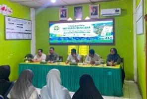
The participatory approach was then strengthened through a Focus Group Discussion (FGD) on August 22, 2026, with the Paya Perupuk Village community. The discussion involved various community elements, community groups, cultural figures, and village officials. Residents' experiences in dealing with floods, frequently affected areas, access barriers, evacuation facility needs, and locations considered safe served as the main input for preparing the spatially based evacuation route and point map.
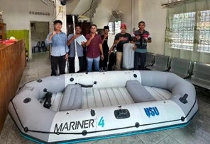
In addition to producing an evacuation map as a guide during emergencies, the FT USU team also handed over a rubber boat as a supporting facility for rescue and community mobility during floods, particularly for residents who require evacuation assistance. The combination of spatial-based mapping and evacuation facilities is expected to enable a faster, more organized, and safer community response.
This activity most strongly supports SDG 11—Sustainable Cities and Communities through strengthening the resilience of settlements to disasters. Preparedness for hydrometeorological risks is related to SDG 13—Climate Action, while the involvement of residents and village government supports SDG 17—Partnerships for the Goals.
FT USU is committed to applying engineering expertise to help communities build contextual and participatory disaster preparedness. Evacuation maps and rubber boats serve as supporting mitigation tools, while their effectiveness still requires socialization, drills, facility maintenance, and regular information updates in accordance with changing conditions in the area.